Five stories: Smart Forest case studies
This section weaves together the research findings from our five case studies with communities that are interacting with smart forest technologies. These case studies do not map easily onto each other – their contexts, dynamics and conflicts are distinct. Rather than elide difference, we home in on the complexities that emerge from each community’s engagement with smart forest technologies, while attending to resonances across stories.
One crucial thread that runs through all the case studies is that smart forest technologies in themselves are not the primary focus of most communities. Instead, they are tools, evidence, resources, and opportunities for amplifying ongoing environmental projects. The forest communities with whom we conducted research were interested in how to deploy technologies to address environmental concerns and achieve their wider ambitions for improved land practices and community connections. These tools are part of structural, systemic and ecological interactions that these communities are encountering.

Smart Forests project drone footage showing Villarrica National Park adjacent to the Bosque Pehuén conservation area. La Araucanía, Chile. Jennifer Gabrys with Smart Forests, 2023.
A drone hovers, fixed in the air by its whirring propellers. It is suspended high over snow-capped Chilean mountains. Dark trees stand tall against the frozen peak of a volcano dusted with ash. In this season, forests are thick with bare wintered trees. Rust-coloured branches intersect with the jagged sculptural forms of dark green monkey puzzle trees, or araucarias. The cold bright skies are high-flung, exposed.
This case study follows the development of a community fire prevention plan in the Palguín watershed in La Araucanía region, Chile. This area is also Mapuche territory, known as Wallmapu, meaning “universe” or “surrounding lands”. The region was the last to be formally incorporated into the Chilean nation in 1882. The Chilean state encouraged European immigration to the area as part of its settlement and colonising process. Today, the region comprises Mapuche people, Chilean locals, second-home owners, tourists, researchers, students, farmers, conservation foundations, and transient populations leaving Santiago for a more rural life.
A distinctive feature of La Araucanía is its many mountains and volcanoes, with some of the most active volcanoes in the world located here. Throughout the region, many forests include the distinctive Araucaria tree (Pehuen in Mapudungun), along with other trees native to Chile.
This research, undertaken in collaboration with the Fundación Mar Adentro, considers how smart forest technologies are used to monitor and prevent fires in the region and at the Bosque Pehuén 882-hectare private conservation reserve in the Palguín watershed. It asks how communities are engaging with and thinking about digital technologies, and the impact that private and publicly owned technology is having on the social-political relations in this landscape.

Smart Forests project drone footage showing forested area in Bujang Raba, Indonesia. Yuti Ariani Fatimah with Smart Forests, 2023.
The drone skims low over a tropical forest in Indonesia. Clouds swim between soft forested hills. We, too, drift at cloud level. The world below is all vegetation. Then the trees are interrupted by bright paddy fields, the terracotta of settlements, a twist of smoke, a river curling past a village, palm oil plantations punctuating the hillside with rigid patterns. Drawing up higher, look over the crest of this hill to the blue hills beyond. The sky is speckled mackerel.
This case study looks at Bujang Raba, one of the first community projects in Indonesia to aim to reduce emissions from deforestation. The project was proposed by a non-government organisation, KKI Warsi, to prevent approximately 630,000 tCO2 emissions by protecting a primary forest spanning 5,336 hectares from 2014 to 2023. The project responds to the significant land-use changes in the surrounding area since the 1980s, with new palm oil plantations, industrial logging and mining having a profound impact on the natural forests of the Bungo Sub-District.
The project covers the five villages of Lubuk Beringin, Senamat Ulu, Sungai Mengkuang, Sangi Letung Buat, and Sungai Telang. By preserving this forest habitat, the project is expected to protect a valuable ecosystem home to endangered plants and animals, including the Sumatran Tiger, Malaysian Sun Bear, Tapir, and sacred hornbills. In this report, we follow how the community involved in Bujang Raba has used digital technologies to protect the forest by monitoring native species, carbon storage and illegal activities. We also document the challenges that have arisen (including with government regulatory changes), and how community dynamics have shifted following the introduction of smart forest technologies.

Smart Forests project drone footage showing Ecodorp Boekel community space. The Netherlands. Michelle Westerlaken with Smart Forests, 2024.
The drone takes in the sweep of the ecovillage in the Netherlands. Architectural rings of houses under construction, a swill of water running along a field drain separating the world of the commercial farm with its brown-ploughed fields, from the world of the ecovillage. Feather-footed bantam chickens, cow parsley tossed by the wind, brambles growing wild, a kitchen garden. A woman calling a dog who is chasing a duck. The drone swoops closer into a high-roofed hut where a group of people sit, deliberating.
Ecodorp Boekel identifies itself as an ecovillage and ‘living lab’ community in the rural Southeast of the Netherlands. Here, inhabitants have spent the last twelve years developing and reflecting upon sustainable forms of living. The community space comprises 36 rental homes and a food forest-garden on a two-hectare site, surrounded by farmland, a protected forest, and the outskirts of a small village. Inhabitants describe the ecovillage as a ‘forest edge’ (bosrand, in Dutch), where humans seek to live in harmony with their natural environment. Ecological transition zones and wildlife corridors have been nurtured on site.
The ecovillage houses 62 mostly Dutch residents, aged between 0 and 71, from diverse socio-economic backgrounds. The comparatively affordable rental costs of the ecovillage homes have attracted people from different parts of the country. Two homes are designated for people with refugee status; two homes are assigned for care-dependent individuals. Other than the refugees, most new residents are selected by current inhabitants. The community is simultaneously more diverse than the surrounding rural area and, paradoxically, rather homogenous in the value systems held by inhabitants. Residents, who often work part-time, are expected to contribute voluntary labour to the community's development (for example, by gardening, doing maintenance, or taking care of outreach activities, finances, or community-building). Inhabitants generally take a keen interest in sustainability-related topics and are knowledgeable in areas such as ecology, permaculture, herbal medicines, communal living, health, Indigenous knowledge, and biodiversity. The living and communication practices are shaped by continuously evolving community-based methods. The community has international links through the Global Ecovillage Network, as well as links with policymakers, sustainability organisations, funders, and industrial partners.
In this report, we follow the Ecodorp Boekel community’s engagements with smart forest technologies, particularly their experiments in biodiversity monitoring, and consider the impacts and interactions these technologies have generated in the ecovillage and beyond.

Smart Forests project drone footage showing Van Gujjar community settlement. Uttarakhand, India. Trishant Simlai with Smart Forests, 2023.
From the drone view, interlocking pathways are seen carved into the landscape. The vegetation is tussocky, patched with trees. Collections of huts gather as though in conversation with each other. The sun glances off tarpaulins tethered over barns beside the straw-roofed homes. Occasionally, bare white-trunked trees like wishbones rise above the scrub. A river draws a narrow glinting needle through the landscape. The markings of the Van Gujjar’s buffalo herds trace journeys in the earth. It is a cold, bright day and the world bristles with lucid sunshine.
Here, Van Gujjar families live on the margins of their traditional forest lands, having been forcibly removed from the Rajaji National Park by the Indian state between 2010 and 2014. The Van Gujjars, who identify as Indigenous to South Asia, follow Islam and practice transhumance and semi-nomadic activities in the states of Jammu and Kashmir, Himachal Pradesh, and Uttarakhand. Within Uttarakhand, where this case study is located, about 70,000 Van Gujjars are spread out across various constituencies in forested landscapes.
This field site gathers 80-90 families, who have been living and practising nomadic pastoralism within current and past generations for the last 200 years. Notably, the term ‘Van’ translates to forest. There are other Gujjar communities in India, but the forest Gujjars are distinct forest dwellers and have historically been persecuted under colonial criminal laws. This report documents how the Van Gujjars have both been discriminated against with the use of digital technologies and how they have engaged with smart forest technologies to map their lands and claim customary rights.

Smart Forests project drone footage showing Ardura Community Forest, Isle of Mull, Scotland. Jennifer Gabrys with Smart Forests, 2025.
Humming over the shallow river, the drone lilts slightly in the wind as it surveys the temperate rainforest. The trees are busy with lichens, mosses, ferns feathering trunks. Rain has blustered in and then out from the Atlantic. The wet-slick leaves of oak, birch, and rowan are catching the light. Beyond the woodland, beyond the deer fence, lies a silent regiment of Sitka spruce, then stark hillside: a Highland landscape at odds.
This case study follows a network of communities involved in temperate rainforest restoration across the West Coast of Scotland. These woodland sites are terrestrial yet marine dependent, washed by rainclouds that gather over the Atlantic. The case study draws particularly on project sites in Ardura, Arkaig, Appin, and Knapdale. However, it also encompasses interviews with other Scottish community woodland groups and private landlords, and draws on a Smart Forests Workshop held in London that brought together policymakers, academics, technologists, community representatives, and NGOs working on forest initiatives.
The rainforest restoration initiatives in Ardura, Arkaig, Appin and Knapdale are based in the local community. Some are founded on community buy-outs, where land was purchased (often from absentee landowners or Forestry and Land Scotland) by the community, usually with funding from government or bodies such as the National Lottery Heritage Fund or Highlands and Islands Enterprise. Since the 1990s, community buy-outs have been increasingly common in Scotland. These community projects are situated within wider networks and partnerships that have emerged around rainforest restoration, most notably the Alliance for Scotland’s Rainforest, which brings together 25 partner organisations. There is a culture of sharing and connecting projects and individuals within these networks.
This report follows community engagements with technologies for temperate rainforest restoration, analysing their use and impact. The report outlines how these technologies have supported the implementation and monitoring of woodland creation, along with techniques for engaging citizens and sharing knowledge.
Engaging and pluralising (digital) technologies in forest communities
Smart forest technologies interact with and mobilise forest worlds in numerous ways. Across our five case studies, we trace how very different communities are engaging with multiple forest technologies and to what ends. We outline community-specific perspectives on these technologies and investigate how digital infrastructures relate to and contrast with community practices and understandings of forests. We ask how encounters with smart forest technologies can be made more plural and equitable, so that these technologies do not obscure local environmental knowledge but rather contribute to and enhance it.

Smart Forests Atlas: Map webpage showing La Araucanía case-study area. Smart Forests with Common Knowledge, 2024.
Community-based fire prevention practices in La Araucanía, Chile
The forested landscape of the Palguín watershed in La Araucanía, Chile, is fire-adapted rather than fire-dependent. Some vegetation, such as the araucaria trees, can withstand lava flows and ember-generated fires from nearby volcanoes. In some instances, low-intensity fire can remove ground-level duff and enable regrowth, but vegetation in this region does not require fire for regrowth (as it does in California, for example). At the same time, landscapes are becoming fire-prone where they previously might not have been due to climate change, rising temperatures and drought, land fragmentation and changing land uses, as well as human activity that creates additional fire risk. Wildfires can pose serious challenges to both ecologies and human habitation in these complex conditions, especially where fires are somewhat newly emerging.
In the context of climate change and increasing land-use pressures, wildfires in the region are growing in frequency and intensity. As such, different agencies within the Chilean government, community organisations, and conservation foundations are developing more localised and technologised fire prevention plans. Community-level fire prevention plans are being designed to map onto the existing nationwide wildfire plans.
There are already many technologies in use in La Araucanía and Chile, more generally, for wildfire and hazard monitoring and management. There is active investment in GIS technologies and data platforms for generating emergency management plans that identify risks and develop disaster response protocols. There are also extant nationwide infrastructures for mapping and managing hazards in the form of volcanoes, earthquakes and tsunamis.
Beyond the broader disaster management infrastructures, Chile’s National Forestry Corporation, Conaf, uses data dashboards, GIS, remote sensing, automated cameras, helicopters, WhatsApp, online toolkits, webinars and training sessions, and many other tools to monitor, identify, prevent, manage, and respond to fires. Some of these technologies are shared across public and private sectors.

Smart Forests film showing Field School participants during site walk at Bosque Pehuén conservation area. La Araucanía, Chile. Mind the Film with Smart Forests, 2025.
In this region, landowners, residents, conservation foundations, and ecosanctuaries also emphasise the role of technology in developing responsible engagement with environments, often for water conservation, regeneration and restoration, and planting native species. Conservation foundations use cameras to identify species and biodiversity hotspots, along with regeneration opportunities.
The Smart Forest Field Schools and accompanying interviews found that communities have a somewhat ambivalent and even contradictory relationship to technology in La Araucanía and surrounding regions in Chile. Multiple research participants noted that Chile is “not very technological,” suggesting that it lags behind nations with more technological approaches to development. In the region, people also feel that technology is at odds with the natural and forested character of the area. In our interviews, workshops and Field Schools, some noted they were wary of techno-solutionism and data collection.
In addition to these perceived or actual technological limitations, the Araucanía region has patchy mobile and Wi-Fi data coverage due to the mountainous and remote character of the region. Not every adult has a mobile phone, and the ability to receive and transmit data can be severely curtailed both for mobile phones and radios. Episodic communication is usual, and in some cases, mountain communities have adopted different systems for communicating through codes and whistles.
This case study revealed the transformations in environmental governance that smart forest technologies can trigger, since Chile’s public sector relies heavily on private infrastructure and networks to monitor fire and issue warnings. The fire prevention project, which gathers interdisciplinary actors from different societal sectors, also suggests the potential for smart forest technologies to enhance forest networks and communities.

Smart Forests film showing Field School participants at Bosque Pehuén conservation area. La Araucanía, Chile. Mind the Film with Smart Forests, 2025.

Smart Forests Atlas: Map webpage showing Indonesia case-study materials. Smart Forests with Common Knowledge, 2024.
Community forest protection in Bujang Raba landscape, Indonesia
The community-managed carbon project in the Bujang Raba landscape covers the five villages of Lubuk Beringin, Senamat Ulu, Sungai Mengkuang, Sangi Letung Buat, and Sungai Telang, and has facilitated multiple forest engagements.
The project, proposed by the non-governmental organisation KKI Warsi, is one of the first community projects in Indonesia to aim to reduce emissions from deforestation. Centred on the REDD+ (Reducing Emissions from Deforestation and Forest Degradation) initiative, the project sought to prevent approximately 630,000 tCO2 emissions by protecting a primary forest spanning 5,336 hectares from 2014 to 2023.
To develop carbon credits that work in the global market, KKI Warsi followed the standards set by the private certification body, Plan Vivo. As such, the project monitors carbon stocks, socio-economic factors, biodiversity, other environmental services, and the drivers of deforestation using Landsat remote sensing to detect land use in the project area. The project also deploys camera traps, fixed-point photography, forest patrols and the Avenza Maps application to cross-check satellite data. Avenza Maps enables forest patrollers to record evidence of illegal tree felling, encroachment, and fires on the carbon project’s georeferenced map. Quarterly and annual monitoring data are stored at the village project office and by KKI Warsi. The local communities of Bujang Raba received training from KKI Warsi on how to use GPS and Avenza Maps. Notably, internet connectivity is poor in villages, with no telecom provider, and limited or absent digital infrastructure, with typically one phone owned per household. Aside from forest monitoring, interactions with digital technology are limited.
To date, this technology-facilitated project has enabled the protection of community forests and ecologies. Some participants in our research suggested that the community project had deepened their knowledge of forest worlds. The project has also been seen to prevent further flooding from occurring in the region by halting some deforestation for palm oil plantations, land use prone to rapid water runoff. Concurrently, the project has provided training and livelihoods for some community members since forest patrollers receive remuneration. In previous years, the carbon project has also funded basic food distribution during Ramadan. However, this has come to a halt due to changes in government regulations that have disrupted the project (something that is covered later in this report).

Smart Forests film of Field School event. Bujang Raba, Indonesia. Mind the Film with Smart Forests, 2025.
During Smart Forest Field Schools, researchers sought to pluralise the use of digital forest technologies by encouraging participants to experiment with technology and imagine possible forest futures. Through Field Schools, researchers also sought to understand how local communities perceived digital technologies and their place in forest worlds. Unlike the case study in Ecodorp Boekel, where forests are seen to be integrated with human infrastructure, participants here conceived of forests as free from human activities and technology, located far from settlement areas. Notably, this binary was fractured slightly by the presence of so-called ‘Wi-Fi trees’ (trees with a stronger signal), which villagers gather around to access the internet.
This case study revealed how local livelihoods and forest engagements could transform following the introduction of smart forest technologies. The NGO-facilitated community-carbon project created jobs in monitoring and forest patrols, led to community members developing new ecological and digital knowledge, and impacted certain gender and generational dynamics (for example, younger men in the community more frequently used the digital technologies). Crucially, this project also revealed complex and uneven power dynamics between the local community, state regulators, technology companies and NGOs. For example, the NGO strongly shaped the communities’ interactions with the forest, technologies and new technical knowledge. These dynamics raise questions about what forms of governance would be most effective in ensuring carbon projects can be community-led.

Smart Forests film of Field School location. Bujang Raba, Indonesia. Mind the Film with Smart Forests, 2025.

Smart Forests Atlas: Map webpage showing the Netherlands case-study materials. Smart Forests with Common Knowledge, 2024.
Community-led biodiversity monitoring in Ecodorp Boekel Ecovillage, the Netherlands
The ecovillage and ‘living lab’ community of Ecodorp Boekel in the rural Southeast of the Netherlands seeks to develop and engage with sustainable forms of living. The community makes use of many technologies, most of which relate to topics of sustainable building methods, energy efficiency, and recycling practices (for example, an on-site battery that stores energy generated by solar panels and converts it into winter heating). The community is interested in and willing to implement experimental technologies and operate as a testbed for developing future sustainable practices. As a living lab, the community seeks to openly share experiences and enable further research on various technologies. Ecodorp Boekel consequently attracts a lot of external interest.
Until this Smart Forests research project, those living in Ecodorp Boekel had limited engagement with digital technologies to monitor local biodiversity. Through this project, the community interacted with various digital biodiversity technologies, including camera traps, acoustic sensing methods with apps like Merlin, and citizen science apps like ObsIdentify. While these technologies are not necessarily high-tech methods for monitoring biodiversity, the digital infrastructures and platforms through which this data is analysed and presented are developing rapidly and using increasingly data-intensive computational practices, such as automated species recognition algorithms and digital twins.
Through this case study, we sought to investigate how these data-intensive infrastructures relate to community practices and understandings of biodiversity on a local level and to understand community perspectives on smart forest technologies. While digital biodiversity technologies were generally embraced and seen as low risk by community members, it became clear that there was a need for these digital technologies to operate alongside other forms of knowledge. Digital technologies for monitoring biodiversity focus mainly on automated species recognition, but this approach could risk erasing other understandings of local biodiversity. Through playful activities in Smart Forest Field Schools, we sought to incorporate and imagine different ways of knowing biodiversity and environments.

Smart Forests film showing birdbox web camera installed at Ecodorp Boekel. The Netherlands. Mind the Film with Smart Forests, 2025.
Notably, this case study is situated in the Netherlands, a country known for its development in digital technology and leading environmental technology innovation sector. One of the most densely populated countries in Europe, the Netherlands is witnessing biodiversity declines linked partly to surpluses of phosphorus and nitrogen. Recent policies seeking to reduce nitrogen inputs into the environment have led to political tensions and farmer protests. In this fraught political and ecological context, nearly everyone interviewed about digital biodiversity technologies on a national level was familiar with this particular ecovillage, revealing how living labs such as Ecodorp Boekel become primary sites for the experimental implementation of technologies.
This case study showed how digital technologies can alter engagements with forest ecologies and biodiversity, suggesting the need for multi-perspectival approaches to forests and technologies. Ecodorp Boekel also demonstrated how smart forest technologies, research and support might be unevenly distributed across regions, with some communities better able to attract funding. Through research with this ecovillage, we witnessed the potential for smart forest technologies to create local, national and international forest networks.

Smart Forests project photo of walking workshop and fieldwork at Ecodorp Boekel. The Netherlands. Michelle Westerlaken with Smart Forests, 2024.

Smart Forests Atlas: Map webpage showing the India case-study materials. Smart Forests with Common Knowledge, 2024.
Participatory mapping of Van Gujjar territories in Uttarakhand, India
Van Gujjar communities living on the margins of their traditional forest lands in Uttarakhand are using smart forest technologies to map their territories and generate Indigenous knowledge. These communities are deploying digital tools, including Google Earth satellite imagery, smartphone mapping tools, GPS systems, and drones.
Following the Van Gujjars’ violent eviction from their lands in the Rajaji National Park by the Indian state (which took place in phases between 2010-2014), the community has sought to assert their land rights through India’s 2003 Forest Rights Act. This landmark law aims to return land ownership to historically dispossessed Indigenous groups. As part of their land claims, Van Gujjars have been creating and submitting digital maps. While hand-drawn maps are often rejected within bureaucratic state processes, digitally generated maps are seen to give accuracy and legitimacy to land claims.
The mapping process is primarily led by the Van Gujjar Tribal Yuva Sanghatan (VGTS), a group of mostly young and educated men, in collaboration with individual researchers and academic institutions. Social media has also given this community a platform to organise and engage. For instance, the VGTS Facebook page and WhatsApp group regularly share knowledge on livestock or environments as well as incidents of harassment, exploitation and persecution by state institutions or other communities. In the wider structural contexts, where odds are stacked against the existence of the Muslim, nomadic Van Gujjars and their identity, smart forest technologies can empower Van Gujjars to map their lands and resist state knowledge production.

Smart Forests film showing Van Gujjar community exploring mapping technologies with Trishant Simlai. Uttarakhand, India. Mind the Film with Smart Forests, 2025.
However, not all community members have embraced digital technologies. Older Van Gujjars are particularly hesitant to use digital technologies due to their deep distrust of state processes. Our research suggested that not only did these members distrust the promise of the Forest Rights Act, but also that they associated forest digital technologies, such as drones and camera traps, with surveillance by the state forest department. Political and logistical problems also arise from the fact that the Hindu Nationalist state has made it technically illegal for Van Gujjars to carry GPS or drones into the forest. Notably, access and ability to use digital technology in this community are not universal, though most adults have access to a smartphone. During Smart Forests Field Schools, Van Gujjars also expressed scepticism about the modes of seeing produced by smart forest technologies, which threatened to obscure community ways of knowing.
This case study points to how smart forest technologies might create dominant views that elide other modes of sensing and relating to forests. The case study also demonstrates how smart forest technologies might reshape power dynamics between the state and the community in differing ways. Here, smart forest technologies are paradoxically used both for state surveillance and participatory mapping. Lastly, this case study suggests the benefits and limitations of digital forest networks and shows how smart forest technologies might reshape dynamics within communities along gender and generational lines.

Smart Forests film showing Van Gujjar women engaged in participatory mapping of forest areas. Uttarakhand, India. Mind the Film with Smart Forests, 2025.
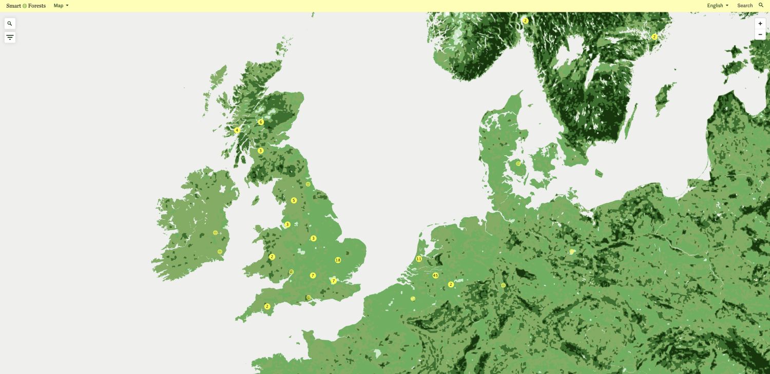
Smart Forests Atlas: Map webpage showing research materials in the UK and EU. Smart Forests with Common Knowledge, 2026.
Community-based temperate rainforest regeneration in Scotland
Communities along the West Coast of Scotland are deploying a range of digital and analogue technologies to implement temperate rainforest restoration projects. This now-rare habitat is found in mid-latitude coastal regions with high rainfall and humidity, and is characterised by epiphytes including mosses, lichens and ferns, and trees such as oak, birch, ash, rowan and hazel.
Notably, the term ‘temperate rainforest’ has gained attention in the UK over the last decade. The growing popularity is evident in the creation of the Alliance for Scotland’s Rainforest, in the Woodland Trust and Wildlife Trusts’ recent promotions, and in the publication of Guy Shrubsole’s Lost Rainforests of Britain (accompanied by a digital map developed by publics). One participant suggested that the word ‘rainforest’ resonates with UK publics due to earlier decades of campaigning by eNGOs and activist groups to save rainforests internationally. The interviewee also stressed that ‘rainforest’ has been a unifying term within the restoration sector, circumventing previous disparate descriptors of these forests, including Native Atlantic Woodlands, Native Oak Woodlands and Ancient Atlantic Woodlands.
These community-led Scottish rainforest restoration projects have emerged against a backdrop of uneven landownership and often degraded landscapes. Scotland is among the most nature-depleted countries in the world, and the Highlands in particular are marked by complex histories of land clearances that de-natured and de-peopled landscapes to make way for more profitable sheep grazing.

Loch Arkaig drone flight with Liam Wright, Woodland Trust, and Jared Child, Arkaig Community Forest. Mind the Film with Smart Forests, 2026.
In our research focused on the four projects of Ardura Community Forest, Beò Airceig: Living Arkaig, Appin Rainforest Regeneration, and Knapdale Restoration Project, we found that the forest restoration and community benefit are highly integrated. These projects have been founded in various ways, including community buyouts, community foundations, and partnerships with eNGOs and landowners. The community woodlands are spaces for regenerating environments and for community connection to the land through harvesting resources, learning skills, and outdoor recreation. The woodlands often contain forest schools, citizen science opportunities, and spaces for nature events and engagement, such as tree-hugging contests (Saving Morvern’s Rainforest). Moreover, forest benefits are understood in relation to wider community needs. For example, in projects where Sitka Spruce plantations are being removed to make way for rainforest, the income generated has been used to build affordable housing for local families, helping alleviate housing crises. In some projects, inexpensive firewood and woodcrafts have been made accessible to the community, and links have been drawn between rainforest regeneration and improving local water supply. Local employment opportunities have also emerged, including roles such as foresters, volunteer coordinators, and deer stalkers.
Within these rainforest restoration projects, technologies are used to restore and manage landscapes. Remote sensing is used to support decision-making on management interventions, with heat maps generated in ArcGIS using ancient woodland (NWSS) datasets. No-fence GPS cattle collars are used in some sites to enable extensive grazing and browsing. Drone reseeding initiatives, which disperse native seed across open hillside, have been carried out in collaboration with the start-up Auto Spray Systems in two projects. Drones are also used to survey invasive non-native species, principally rhododendron, so the plants can be removed manually. Drones are deployed to provide thermal imaging to facilitate deer stalking and management. Both deer and rhododendron can hinder rainforest regeneration, as deer graze saplings, and rhododendron competes for habitat and prevents light from reaching native seedlings. These species are markers of large landownership, as Rhododendron ponticum (a hybridised plant imported to the UK at the height of colonialism) was a popular feature of Victorian estates and gardens, while deer stalking is often an exclusive sport.
Biodiversity monitoring technologies are present in restoration initiatives, including camera traps, acoustic and eDNA monitoring devices, and citizen scientists using apps such as iNaturalist. Remote sensing is also used by certain projects that were (cautiously) investigating carbon and BNG credits while creating initial baselines of species richness. Some projects are collaborating with startups in this space, such as Zora Ecosystems and RePlanet.
While a range of forest technologies are deployed across these rainforest restoration projects, participants often played down the idea that these technologies were incorporated into their projects. Unlike land and community, land and technology were largely seen as diametrically opposed rather than integrated. This may reflect the fact that technologies are often deployed by specialists, visiting or resident scientists, or contractors, rather than local publics.
Ultimately, this case study revealed not only the impacts of smart forest technologies and their potential to strengthen and enable networks, but also reinforced the fact that these technologies are only a means to an end. Community empowerment, participation, and integrated visions of rainforest and community life were found to be most fundamental to sustainable, long-term regeneration.

Rainforest at Argyll and Countryside Trust with Philippa Mckee and Julie Young, Lochgilphead, Scotland. Mind the Film with Smart Forests, 2026.
Understanding power and equity in smart forest worlds
Across our five case studies, communities diversely used and perceived smart forest technologies, demonstrating the importance of place-specific research and place-based practices. Some were wary of forest monitoring devices in the wider context of hostile governments; some feared techno-solutionism; while others saw digital technologies as carrying minimal risk. Certain communities emphasised nature as separate from human digital infrastructures, others saw natural, cultural, and digital infrastructures as integrated. However, common to all communities was the need to navigate smart forest devices and data alongside other ways of sensing forest worlds. Smart Forests Field Schools sought to find ways to integrate digital technologies alongside ancestral, analogue, and ecological technologies and invited communities to consider the social-political impacts that digital technologies generate.
Smart forest technologies have social-political impacts on communities that reverberate beyond installing and using technological devices and infrastructures. These five case studies offer insights into the complex social-political dynamics of smart forest technologies. Far from being neutral devices, smart forest technologies can shape power dynamics within and beyond communities, generate networks, transform governance structures, and pluralise communities’ engagements with forest worlds.
In what follows, we elaborate on our key findings by drawing out the consequences or co-benefits of smart forest technologies that were evident in case study communities.
Smart forest technologies are changing forest engagements and livelihoods [Finding 1]
Digital technologies can create new livelihoods and forest engagements. This was seen in Bujang Raba, where forest patrols have created employment opportunities. It was also evident in Scotland, where drones have improved the efficiency of deer stalking and where drone reseeding technologies have improved worker safety, circumventing the need to plant manually on steep slopes prone to landslips. These technologies can also broaden ecological knowledge by offering access to educational resources, such as species identification applications. However, these technologies also produce knowledge and practices that can obscure other ways of seeing and sensing forests. Digitalised approaches to forests can accelerate understandings of forests as extractable resources, or as carbon stores to offset fossil-fuel emissions. Each case study community had to navigate integrating digital ways of encountering forest worlds with ancestral, ecological, and analogue forms of knowledge.
The Van Gujjar community, in particular, expressed scepticism about the modes of seeing and sensing produced by smart forest technologies. Research participants in this location discussed how satellite images and state-produced maps used to showcase forest canopies as green landcover worked as misrepresentations, obscuring the forest understorey and other ecological markers. The inclusion of monocultural plantations, such as eucalyptus, caused particular frustration since these plantations are seen to degrade forest biodiversity, generating very little understorey while sapping groundwater. For the Van Gujjars, mapping goes beyond counting elements in a space, acting instead as an opportunity to relive the geographical, ecological, cultural, economic, and social aspects of a place. For example, local sites are named after significant events in the lives of both the Van Gujjars and their buffaloes, with a stream referred to as ‘si’ talai, meaning tiger waterhole, due to frequent tiger encounters.
In order to counter the reductive potential of these smart forest technologies, Van Gujjars and our research collaborators worked to pair digital technologies with community knowledge. During Smart Forests Field Schools, we first mapped landscape and community activities on paper, where cultural and social markers could be more readily included. We then used these paper representations to create digital maps that would retain social and cultural knowledge, thereby increasing the accessibility of the activity and pluralising ways of knowing.
Likewise, in Ecodorp Boekel, participants questioned how data-intensive infrastructures related to community practices and understandings of biodiversity. Community members noted that while digital data circulates as seemingly ‘neutral’ and ‘objective’, the species that digital technologies can detect are often limited, leading to issues of species prioritisation and over-representation in datasets. Moreover, how local communities engage with data is usually highly selective. Participants, for example, narrated and selected data to suit their individual environmental concerns. For example, participants were more likely to generate digital data and documentation that suggested a negative relationship between biodiversity and pesticide use on the local farm than other data points. Such practices demonstrate the importance of pluralising engagements with digital technologies to account for more pronounced environmental concerns, while acknowledging biases in their use. In this way, digital infrastructures could be mobilised less as ‘mirrors’ of ecosystems and more deliberately as tools to narrate environmental stories and problems.
Through Smart Forests Field Schools in Ecodorp Boekel, we facilitated playful discussions of local biodiversity with an interactive installation that suspended QR code-printed cards from the ceiling of the community hub. This installation enabled participants to combine digital data on biodiversity with other ways of knowing their environments. Community members enriched the digital data with knowledge of local land-use conflicts, biodiversity, pollution levels, health and well-being. They further identified possibilities for human land use to co-exist with and enable improved biodiversity by mobilising approaches to communities as more-than-human entities. Through forest walks and conversations with local artists and foresters, community members further enhanced the digital data produced on biodiversity.
During research in the UK, we noted that technologists working on nature restoration often considered their work to be separate from social science and engagement within projects. At the Smart Forests Workshop held at Kew Gardens, policymakers, technologists, eNGOs, and community representatives discussed the siloing of social science, natural science and technologies. Workshop participants sought greater disciplinary integration that would better enable digital technologies to complement and reflect community and other ways of seeing and sensing forests.
Our research suggests that smart forest projects should ensure technologies do not reduce forest worlds—into mapped observations from above, into monetisable carbon or species data—but rather that these technologies should contribute to, complexify and enrich existing community ways of sensing and inhabiting forests. Diverse epistemic contributions to forest engagements, drawing on natural and social sciences as well as community knowledge and experience, could enable more inclusive technologies to be developed.

Smart Forests film of biodiversity digital data installation at the Ecodorp Boekel community hub. The Netherlands. Michelle Westerlaken with Smart Forests, 2023.
Smart forest technologies are unevenly distributed, and resources are often scarce [Finding 2]
Smart forest technologies are unevenly distributed within and among communities, which can be compounded by a lack of monetary, personnel, technical or other resources. The uneven distribution of digital technologies can reshape, disrupt or entrench existing power dynamics. For communities to lead and contribute to the design and use of smart forest technologies, initiatives must be carefully developed to enable knowledge and expertise to be equitably distributed.
The distribution of technologies and resources to certain communities and not to others can create regional disparities. Smart forest technologies can be unevenly dispersed as they are often introduced to communities through partnerships with technology companies, private foundations, or research organisations. Some forest communities, such as those situated in ‘iconic forests’, are more likely to receive support for smart forest technology from private and public sources.
In Chile, we encountered the unequal distribution of technologies, resources and skills networks. Chile’s National Forestry Corporation, Conaf, has developed somewhat generic fire prevention plan toolkits. However, in some areas, independently resourced community organisations and private foundations are undertaking bespoke plans and projects for local fire prevention. This points to a need for greater collaboration across sectors, organisations, and initiatives to facilitate the sharing of resources and knowledge and prevent regional discrepancies. Resource shortages are an ever-present concern, as many government organisations do not have sufficient resources to mobilise communities, while community groups often lack funding, technologies, and expertise. By building community fire prevention networks and plans that connect across regions, it could be possible to generate ways of sharing funding opportunities, knowledge, and tools in ways that help address resource problems.
The uneven regional distribution of technology was also apparent in Ecodorp Boekel. With its international reputation as a living lab, the ecovillage benefitted from a PR team and committee dedicated to writing grant applications, which regularly translated into funding and technological support. Ecodorp Boekel sits on the outskirts of a more typical Dutch rural settlement. While efforts have been made on both sides to facilitate interaction—through regular ecovillage open days and annual meetings—there are discrepancies between the funding received and values held in these habitations. Asymmetrical support and funding prioritising certain communities over others can perpetuate cycles that further exclude less-connected communities and deepen inequalities.
The ability to access and use smart forest technologies can also be disparately distributed within communities. Our research found that this disparity often occurred along lines of expertise, gender, class or in relation to other pre-existing inequalities. This was particularly evident during our research with Van Gujjar communities in Uttarakhand and with communities in Bujang Raba, where traditional gender and generational roles are rigidly defined. In both these case studies, smart forest technologies slightly shifted dynamics along generational and, to a lesser extent, gender lines.
Access to and use of digital technologies among the Van Gujjars is primarily limited to young men with secondary education. In this community, the family patriarch typically showed little interest in digital mapping or the community organisation, Van Gujjar Tribal Yuva Sanghatan (VGTS), which is seeking to secure land rights through the Forest Rights Act. The older generations often distrust both technologies and state processes. Such a situation leaves younger, educated men as the main users of smart forest technologies.
Similarly, in Bujang Raba, smart forest technologies tend to be operated and understood by young people, particularly those who work in forest patrols. These technologies have strengthened the youth’s position in the community and led to changes in the Village Forest Management Unit, previously dominated by older men, to include youth. KKI Warsi has also established youth-only activities, something which has caused tensions, with the head of one village complaining that the NGO focuses more on young than elderly people. These smart forest technologies can create status and social bonds for the younger men in these communities and render older men less important. There is a risk that smart forest technologies can lead to the erasure of certain older generations’ values and ways of sensing and inhabiting forest worlds.
Smart forest technologies also had minor impacts on women’s position in these highly gendered communities. In Van Gujjar communities in Uttarakhand, women do not participate in decision-making bodies and tend to spend more time in the forest than men. However, since the emergence of the Van Gujjar Tribal Yuva Sanghatan (VGTS), women have begun to be involved in placemaking and participatory mapping processes and a women’s wing has been established. During the Field School, the differing priorities of genders in the Van Gujjar community became apparent through the contrasting sites they mapped. Meanwhile, in Bujang Raba, the community carbon project has led to the establishment of women’s cooperatives in five villages, which produce handicrafts such as rattan. Nonetheless, the gender segregation in work and social settings has persisted, and women are absent from the Village Forest Unit committee. Community-led smart forest projects can create new opportunities across gender groups, but they may also perpetuate traditional dynamics.
Notably, our Smart Forests research project contributed to some of these dynamics of disparate resource distribution since by selecting specific communities to work with. We chose these case studies partly because individual researchers have ties to the locations and partly as they offered opportunities to understand how communities were engaging with smart forests in relation to prominent environmental concerns of fires, carbon, biodiversity, land rights, and rainforest regeneration. In sharing our findings beyond these selected case study communities, we hope to contribute to broader networks of knowledge and suggest interventions in how research, knowledge, and funding are distributed.

Smart Forests film showing two forest patrollers using the Avenza mapping application. Bujang Raba, Indonesia. Mind the Film with Smart Forests, 2025.
Smart forest technologies are transforming forest governance [Finding 3]
Smart forest technologies have led to the increased participation of technologists, researchers, eNGOs and multinational corporations in forests. Since these external actors often design, develop or control the technologies and networks, smart forests are causing transformations in environmental governance. Our research suggests that smart forest technologies are shifting governance away from communities and local and national government actors, and towards startups, researchers, NGOs, and private technology companies.
Transformations of forest governance in relation to data practices were apparent in La Araucanía, Chile. Here, public and private sectors share forest technologies and data, with private forestry companies owning much of the technology used to monitor, predict and prevent wildfires (such as watchtowers and cameras). The forestry companies share data through data dashboards and command centres with the National Forestry Corporation, Conaf. It is unclear if this data sharing is voluntary or required by law. The data does not appear to be available to communities and is maintained within a more expert and hierarchical space of oversight and decision-making. Many of these fire technologies give rise to an expertise gap, since firefighters and rangers can have access to data and tools that are not readily available or used by local communities.
Moreover, Chile’s forest governance is also entangled with private companies in key aspects of its communication infrastructure since WhatsApp is relied upon to issue fire warnings and coordinate responses. This dependency raises questions about the possibility for local communities to lead these projects. It points to a transition of environmental governance away from public bodies and towards private technology companies. It suggests that public ownership of technologies and infrastructures or, at least, diversifying the private providers of technologies, might enable smart forest projects and state environmental departments to be more resilient.
In Bujang Raba, we saw on a more localised level how forest governance can transform when local communities become entangled with external partners. While the community owns the data collection devices (the Village Forest Management committee owns the GPS devices, and smartphones are personal), the data collected is less accessible to the local community for analysis and is processed by experts in the NGO KKI Warsi’s main office in Jambi City. KKI Warsi also carries out the more high-tech Landsat data collection and analysis. Notably, practitioners do not use data management forms and have less articulated approaches to data ownership and privacy. In addition, community members are trained to use technologies geared toward meeting the standards of the private certification body, Plan Vivo, rather than being useful to the communities’ daily functioning.
In Ecodorp Boekel in the Netherlands, local participants again raised concerns about expertise gaps, rapid technological innovation, and increasingly complex computational features outstripping community knowledge. Local community participants also noted that they can spend significant time and energy helping external researchers with their research projects. On the one hand, this shows how community members can integrate their values of making biodiverse futures into their everyday lives. On the other hand, it demonstrates how external experts with funding might intervene in the governance and ambitions of a local environment project.
In Scotland, communities raised concerns about technologies that facilitate remote decision-making. Aerial imagery and in-situ sensors enable UK government agencies such as Forest Research to monitor forests, often operating hundreds of miles from local sites. Some participants feared that these remotely operated technologies might curtail local decision-making on landscape-scale change, thereby disempowering rural communities.
In light of these findings, our research pointed to ways communities can effectively govern smart forest initiatives and be involved throughout data collection, processing, and design. Good practices included external supporting bodies, such as NGOs, offering sustainable long-term funding, training and engagement. This can be seen in KKI Warsi’s long-term commitment to the Bujang Raba community. Here, relationships have been sustained over long durations, with KKI Warsi field team members staying in the villages for three weeks each month. KKI Warsi has also offered training to community members. Likewise, legal researchers have worked alongside the Van Gujjar communities in Uttarakhand for a decade. This iterative, slow ongoing and research helps build trust and community skills. In addition, smart forest technologies should be accessible to as broad and diverse publics as possible; data ownership and privacy should be clear to community members; and low-tech, cheaper technologies such as citizen science apps or GPS devices should be used where possible.
Our research also suggested that living labs such as Ecodorp Boekel could enable smart forest technologies, currently developed almost exclusively by technologists, ecologists, and project funders, to be designed more democratically. Living labs can enable communities to provide feedback on technologies being trialled on-site and intervene early in their development. However, a delicate balance must be struck to ensure that the questions of researchers align with the questions and interests of living lab community members. Careful, trusted partnerships must be formed to enable communities to lead these smart forest projects and avoid asymmetries of power and information access.
Our own Smart Forest research intersects with these dynamics. As such, we sought to create reciprocal and sustainable engagements, offering teach-ins on how to use technologies, holding collaborative multi-actor Field Schools, conducting iterative engagements, commissioning contributions, and foregrounding community voices in research outputs. We also hope that the project outputs, including reports, films, podcasts, and academic papers, can be useful to communities (for example, as evidence of international attention for Van Gujjar communities submitting land claims). We would like this report to prompt critical discussions about transformations in environmental governance, both locally and beyond.

Smart Forests film showing weather station at Bosque Pehuén conservation area. La Araucanía, Chile. Mind the Film with Smart Forests, 2025.
Smart forest technologies are shifting power dynamics between communities, states and tech companies [Finding 4]
Both state actors and technology companies use smart forest technologies to increase the regulation, transformation, datafication and observation of not only forest worlds but also forest communities. For example, the Hindu nationalist Indian state used smart forest technologies such as satellite imagery, camera traps, and drones to produce knowledge that led to the initial dispossession of the Van Gujjars from their lands. The Van Gujjars, who are viewed by the state as encroachers on forest land, face political marginalisation due to their Muslim, nomadic identity. Smart forest technologies continue to be used by the state for surveillance, intimidation and control of Van Gujjar communities (with reports of drones being used to spray disinfectant on communities during Covid-19). The state also restricts Van Gujjars’ ability to use smart forest devices such as GPS.
In Indonesia, state regulation has intervened, though in less insidious ways, in the Bujang Raba communities’ ability to deploy smart forest technologies to their own ends. The community carbon project in Bujang Raba was abruptly disrupted in October 2021 when the Indonesian government issued Presidential Regulation No. 98/2021 (Reg 98) on implementing carbon economic value for achieving Nationally Determined Contribution (NDC) targets. Under this new regulation, all carbon activities in Indonesia can only continue once the Indonesia Registry System has approved them. In response to the new regulation, KKI Warsi registered the Bujang Raba project in early 2022 and underwent a new verification based on the Indonesian regulation. However, the registry system has still not approved the project at the time of writing this report. This has resulted in uncertainty for the community project and demonstrated how community-led projects can be subject to forces beyond their control.
Smart forest community projects can also become precarious through the involvement of private technology companies and funders. For example, Ecodorp Boekel relies on external funding to carry out community and development initiatives. This dependency on external funding creates friction, for while the ecovillage intends to be a space for learning and experimentation, there is internal and external pressure for it to present as a flagship project and successful testbed to attract further funding and support. There is a risk that if experiments fail, the living lab will not be fully open about results for fear of impacting future funding opportunities. These findings underline the importance of connecting innovation practices to their social-political relations and finding ways to enable communities to share (self-)critical practices, uncertainty and ongoing issues in connection with the testbed research and innovation, without the threat of funding being withdrawn.
Conversely, our research demonstrated how some digital technologies might help to empower forest communities by offering tools to document illegal activities and abuses, map and assert land rights, and create alternative narratives to those produced by states or private companies. This is clear in the Van Gujjars’ practices of mapping their lands for the Forest Rights Act using geospatial tools, including drones and GPS devices carried on buffaloes’ horns. Similarly, in Bujang Raba forest patrollers use technologies to document encroachment on forest lands and to create evidence for conserving these spaces. Meanwhile, in Ardura Community Forest, Scotland, the project has installed QR codes along watercourses to enable forest rangers and citizens to report pollution entering the site.
The use of smart forest technologies for surveillance and monitoring may empower or endanger communities, depending on who processes the data. In the UK, while some research participants were enthusiastic about the potential for technologies to monitor illegal activities in woodlands and environments (for example, tree felling and commercial cockle-picking), there are risks that environmental surveillance could be misused by data processors and authorities, and that forest activities will be taken out of their social and political contexts.

Smart Forests film of Van Gujjar community using different mapping tools to document encroachment by eucalyptus plantations. Uttarakhand, India. Trishant Simlai with Smart Forests, 2022.
Smart forest technologies can strengthen and enable forest networks [Finding 5]
Community-led smart forest projects can disrupt traditional power dynamics by enabling communities to connect beyond their geographical boundaries and engage with broader environmental concerns.
On the West Coast of Scotland, rainforest regeneration initiatives are often situated within wider environmental networks and partnerships. These partnerships are not solely digitally enabled; however, digital knowledge sharing through webinars, websites and online meetings plays an important role in strengthening and enabling these networks. In the rainforest space, Alliance for Scotland’s Rainforest gathers 25 organisations, including Plantlife, RSPB, ACT, NatureScot, and Native Woods Co-op, and supports various restoration and community projects. Beyond this, networks such as Community Woodlands Scotland and Scotland: The Big Picture draw together nature restoration initiatives and share learnings. Community knowledge and imaginaries are also supported through open-access online tools such as Forgotten Woodlands, which maps ancient woodland place names and connects cultures to land across Scotland.
Successful on-the-ground working partnerships have also emerged through these networks, with community forests partnering with large eNGOs. This is evident in the partnership between Arkaig Community Forest and the Woodland Trust. This partnership has enabled the community to draw on Woodland Trust’s ecological and technical expertise and resources, while the Woodland Trust has been able to access community buy-in and trust. Participants in Scotland and at the Smart Forests stakeholder workshop emphasised the importance of knowledge exchange and digital connectivity between different initiatives, and expressed a desire for open data access across organisations and sectors.
Similarly, Ecodorp Boekel is integrated within networks that connect through digital platforms and communication tools. The ecovillage has developed connections with the Global Ecovillage Network, national and local sustainability organisations, three local ecovillages, funders, and industrial partners through digital networks and technological experimentation. The community is also actively involved with various actors at different levels of governance, including local municipality politicians, stakeholders at the provincial and utility-company level, and EU funders.
The Van Gujjar Tribal Yuva Sanghatan (VGTS) has mobilised technologies to develop its networks. For example, the VGTS uses their Facebook page and WhatsApp group to share knowledge on topics such as grazing, wildlife, deforestation, and livestock depredation, as well as incidents of harassment, exploitation and persecution by state institutions or other communities. Digital networks have also enabled the Van Gujjars to connect to the social organisation, the People’s Initiative for Forest Rights. However, aside from occasional meetings and workshops on the Forest Rights Act, the Van Gujjars have limited engagement with this group due to time constraints and the theoretical nature of discussions that do not always map onto the Van Gujjars’ specific context. In a related way, in Bujang Raba, the carbon monitoring community project has enabled connections with KKI Warsi, Plan Vivo and carbon markets. These extended networks broaden—and complicate—concepts of community.
In La Araucanía, Smart Forest Field School participants and interviewees expressed strong support for connecting and strengthening forest networks through the involvement of a greater range of actors. Many felt that technology could facilitate these developments, enabling connections between academic, artistic, conservation, state and community representatives. Additionally, they saw education as a way to shift the primary focus of wildfire technologies from emergency response and management, toward prevention, communication, and education.
Field School participants and interviewees noted that non-state organisations and sectors, including universities, foundations and NGOs, can play an important role in broadening and enhancing the educational and preventive components of forest fire knowledge and responsiveness. Some Field School participants and interviewees noted a disconnect with universities, suggesting that these institutions could be more central in fostering dialogic, citizen-oriented contributions, while supporting community networks and their environmental observations.
As interviewees point out, communities can also educate the state, as they often know the most about their territory and are accustomed to responding comprehensively and effectively to hazards that occur. At the same time, some interlocutors suggested that ministries could be more joined up to understand environmental problems in their complexity rather than on a single-issue basis. Our research indicates that if fire prevention is to be foregrounded in La Araucanía as a key component of wildfire practices, then more robust and diverse social organisation, pluralistic environmental engagements, and creative ways of engaging with education and technology are required to create and sustain effective community involvement.

Smart Forests film showing field school participants discussing biodiversity plans and practices at Ecodorp Boekel. The Netherlands. Mind the Film with Smart Forests, 2025.

Smart Forests film showing Field School. Bujang Raba, Indonesia. Mind the Film with Smart Forests, 2025.