FIRE TECHNOLOGIES
Fire Technologies
Smart Forests and Fundación Mar Adentro
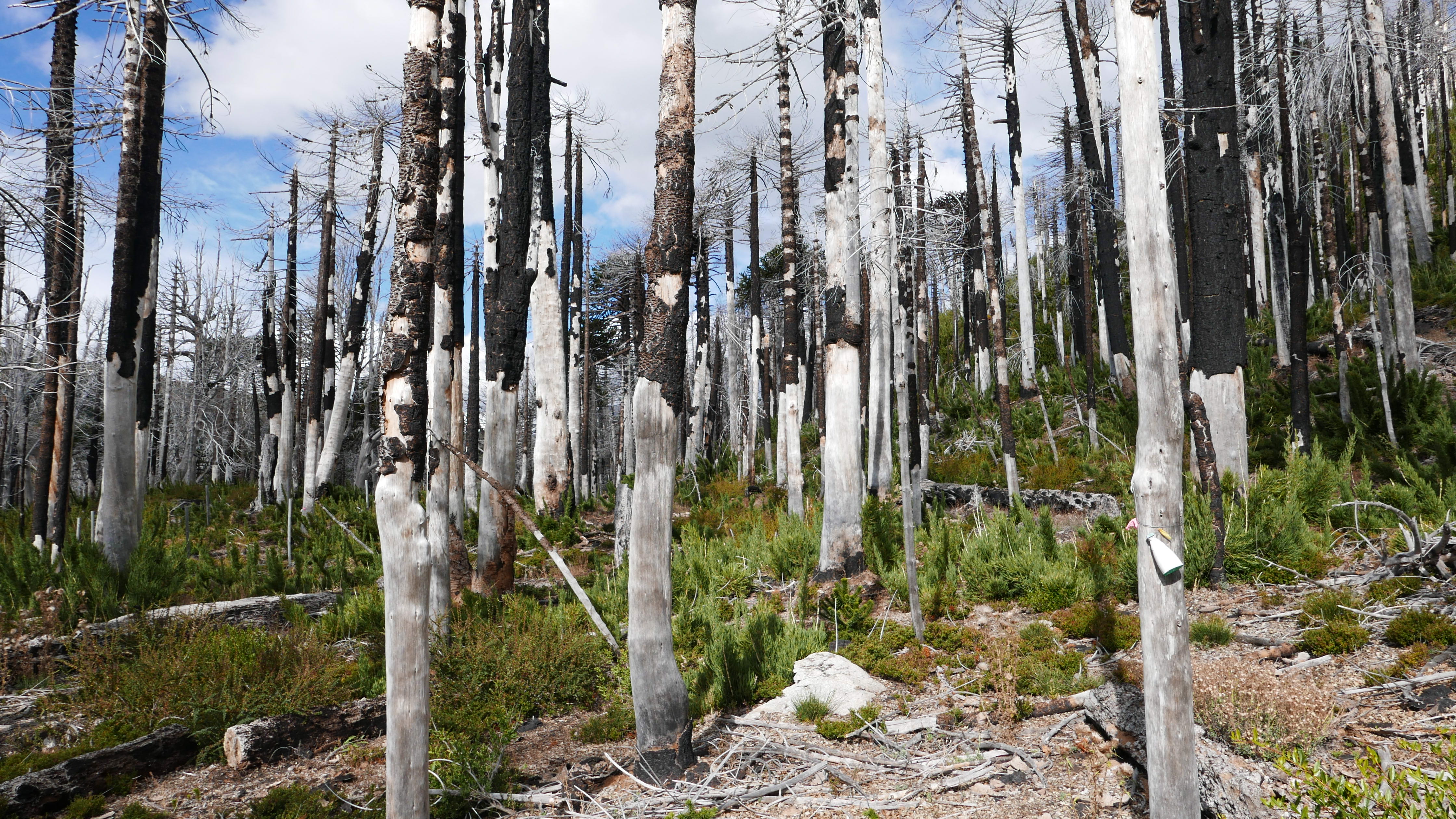
Fire can be seen as both a technology and a process increasingly organized through technologization. As mentioned in the introduction to this collection, fire has been a crucial technique for Indigenous communities to shape landscapes worldwide, including those in Chile. As Luis Otero Durán describes in his text, La Huella del Fuego (or The Trace of Fire), fire was a tool that Indigenous communities, including the Mapuche, used to manage the landscape and facilitate agricultural cultivation. However, with the arrival of European colonizers, forest management practices emerged that relied more heavily on extensive deforestation and the intensive exploitation of natural resources. Such practices were less reliant on fire as a low-intensity tool for shaping landscapes, and fire became restricted and even prohibited for these uses.Otero, La Huella del Fuego. Nevertheless, in the Araucanían landscapes surrounding Temuco today, many controlled burns still occur, and they remain an important part of agricultural practices.
Now, with the rise of severe, destructive fires, technologies (or “fire tech”) are also emerging to monitor, suppress, and prevent wildfires.Wonder Labs, The State of FireTech Annual Update; Lakhina and Gabrys, “Shefali Lakhina.” Devices, including satellite-based remote sensing and geospatial datasets, drones and thermal sensing, camera traps, AI-imaging techniques, and autonomous vehicles, are just a few of the digitally enabled tools and infrastructures that have emerged to address the growing problem of fire. This chapter provides a snapshot of the fire technologies in use in Chile and how they could be transforming fire practices, governance, and community engagement.
Similar to the previous chapter, we draw on findings from the Field Schools, interviews, fieldwork, and art-science residencies. Participants and collaborators noted the limitations that fire technologies can bring, both in terms of potentially contributing to the further marginalization of communities and at times not functioning well in mountain environments. At the same time, they pointed to how technological resources could help respond to fires more effectively, whether through communication networks or data that establishes where fires have occurred or could occur in the future. Most importantly, fire technologies should, as many interlocutors noted, ensure that communities are not forgotten in the further development of these technological systems.
Fire technologies in Chile
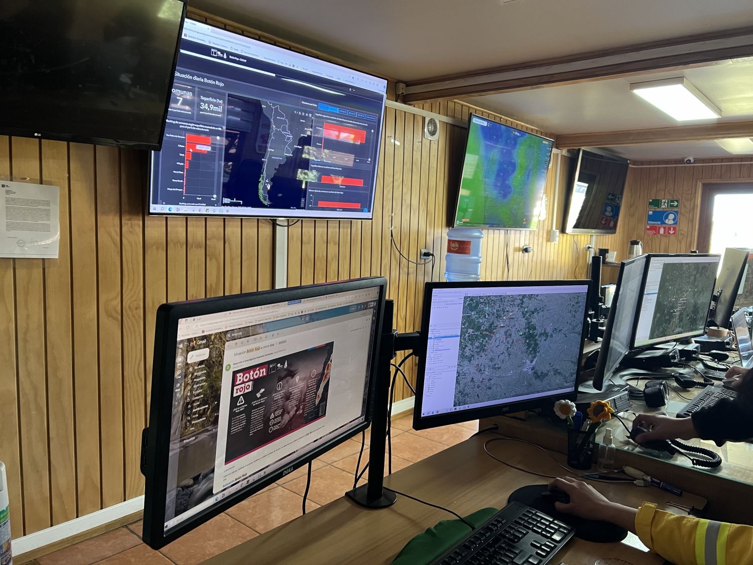
When asked which fire technologies were evident in Chile, respondents identified a range of tools designed for monitoring, predicting, and responding to wildfires. Field School participants and interviewees with experience across research, land management, community organizing, and public services identified how fire and forest technologies are often interconnected and consist of many layered components. Technologies are used for early detection and real-time monitoring of fires, typically relying on satellite imagery and Geographic Information Systems (GIS) to map fire-prone areas, locate water sources, identify fire hotspots, and pinpoint incidents.Saavedra et al., “Jorge Saavedra.” Georeferenced risk maps and early detection technologies can facilitate both rapid response and long-term environmental management.
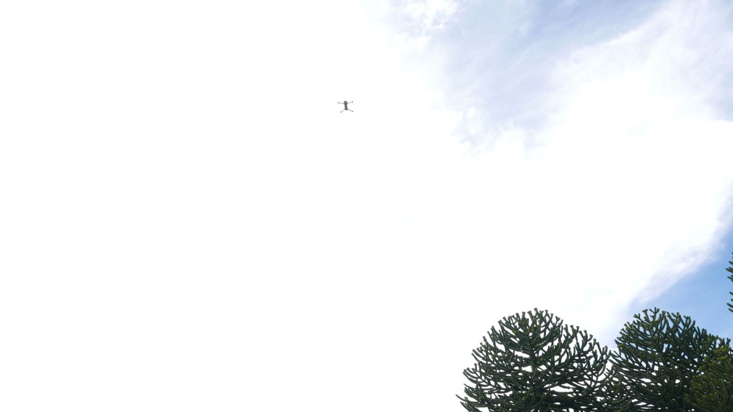
In addition to satellite imagery, camera traps, surveillance systems, drones, and thermal or multispectral sensors are used to detect and monitor fires, often through control centers. Thermal sensors can detect heat anomalies and track fire patterns, while drones and autonomous vehicles can scan and access hazardous or inaccessible areas. Meteorological station data can complement remote sensing datasets, providing grounded information about local fire contexts and events. These tools can also be useful for monitoring flora and fauna after fires occur to track recovery and restoration efforts.
Fire platforms often bring together distinct and diverse datasets to coordinate detection and response. From wildfire spotting to users reporting events via apps to data integrated through CONAF control centers, platforms and apps can connect more remote tools and infrastructures with community-based tools. Such platforms are beginning to emerge, including through CONAF web-based platforms that deliver relative real-time information to users in the form of the Sistema de Información Digital para Control de Operaciones (SIDCO) (or Digital Information System for Operations Control) and Situación Actual y Pronóstico de Incendios (or Current Situation and Fire Forecast).See CONAF, «Oficina Virtual» and «Situación actual y pronóstico de incendios».
Communication technologies play a crucial role, with WhatsApp, Facebook, and local or community radio networks facilitating fast and direct information sharing. Social media can enable rapid alerts and citizen participation, but it also carries the risk of relying on Big Tech companies for critical infrastructure.Hamilton-Jones et al., Community-led Forest Technologies. Strong mobile network coverage is also essential for these tools to operate, which can pose a problem in mountainous regions. Together, these technologies create a layered approach that supports fire prevention, community organization, rapid response, and ongoing land management.
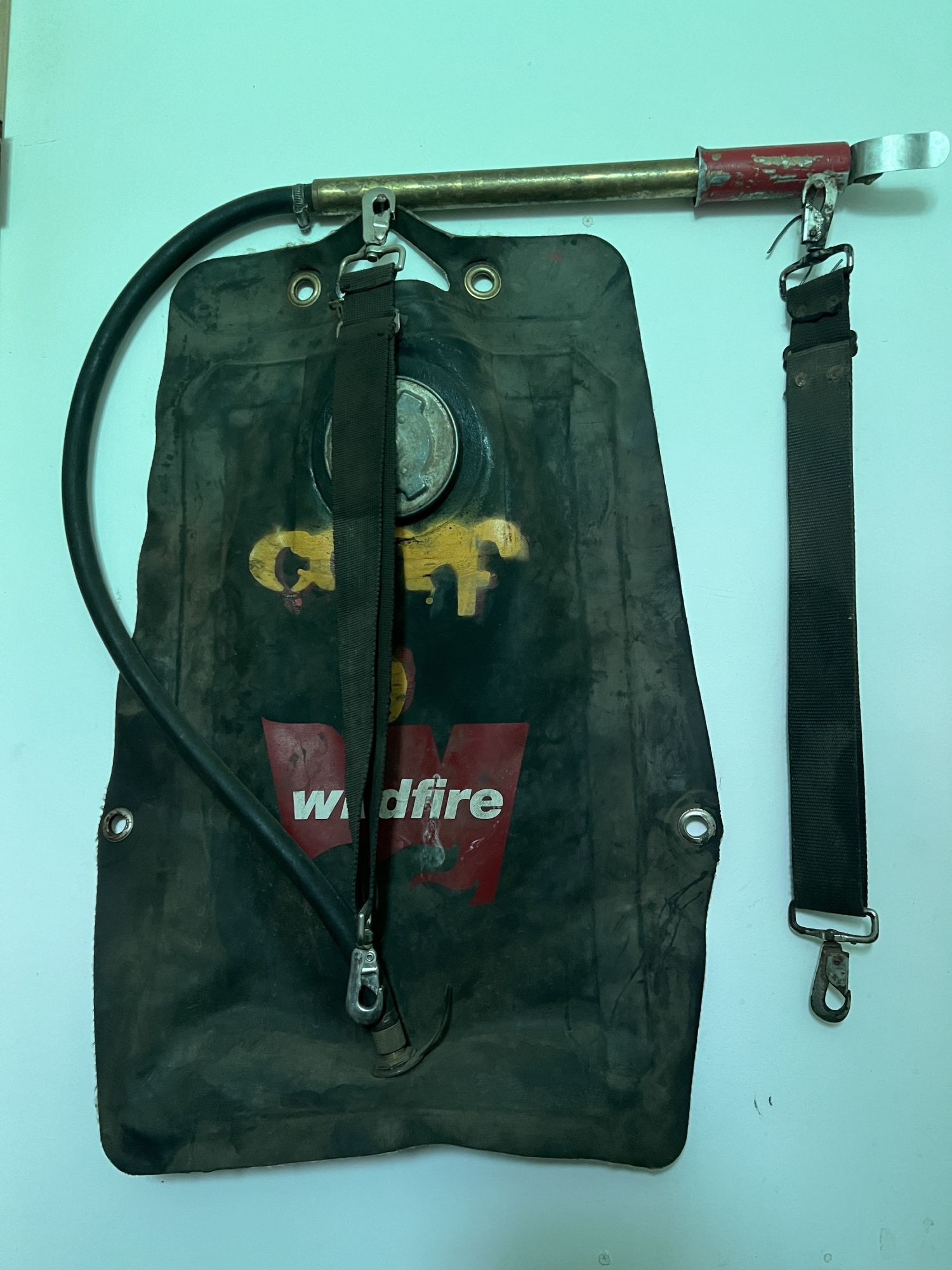
However, digital technologies are only a part of the extended technical infrastructure and knowledge that people have found relevant to wildfires. They also noted that the presence of infrastructure and equipment in local territories can aid wildfire response. Such infrastructure and equipment include community and emergency centers, telephone signal antennas, water towers, tanks, taps, hoses, sprinklers, radio communicators, tools, specialized clothing, among others. In addition, the active incorporation of local knowledge and practices for fire prevention counts as a key “technology” within land practices. Finally, technical training in land management, fire prevention, and response is a key component of a fire technology toolkit, with ongoing learning and training opportunities central to fire resilience.
This broad survey reveals that Chile has extensive and effective infrastructures for fire management. However, many interviewees and Field School participants raised questions about the accessibility of the technologies. Typically, industry and academic researchers lead the acquisition and application of fire technologies, as these sectors possess greater resources and technical capabilities to utilize and analyze datasets. When fire information is shared, it is often in a format that communities cannot readily access or understand, requiring additional training and familiarity with GIS.
For this reason, many communities do not engage as fully with available technologies and datasets as they would like. Rather than having access to and understanding of fire risk maps, predictive models, and situational platforms, communities often revert to using WhatsApp and camera trap viewers, and radios during emergencies. While a lack of knowledge, financial resources, and technical capacity are significant barriers to accessing and using fire technologies more readily, social barriers also exist in industry and academic sectors, where those managing technical resources can be less connected to the community and public institutions. With a collaborative approach to fire technologies and information, these systems could be co-designed to be more responsive to community needs and practices.
Community-based fire technologies
In this sense, when considering how new fire technologies are changing or could help to mobilize community fire prevention practices, many interviewees and Field School participants stressed the importance of not marginalizing communities through the use of technology. As two Field School participants each noted:
“We believe it is important not to marginalize communities through the implementation of technologies and to look for ways to create a mixed system that takes into account the context of the community and new technologies and seeks to generate more connectivity and training in the use of technology.”
“We need more human and economic resources for social progress […] we need to reduce the digital and language gaps between academia and its neighbors and the territory.”Group discussions at the Smart Forests Field School, Temuco (April 2024).
Participants suggested that a fire detection network oriented toward community use and providing open data would be ideal. Such a system would be accessible and offer both real-time satellite imagery and local observations. Technological training and resources would be available to ensure genuine community engagement. This would be accomplished alongside fire prevention training for local communities, utilizing techniques such as collaborative mapping and the use of emergency alert systems. Existing communications campaigns would also promote the fire detection network as part of regular updates on fire risk, ensuring that messages are widely communicated.
Such a network would require technological coordination and education to ensure the widest possible community engagement and interconnection with existing land and fire practices. It would also be future-oriented in considering changing land uses, demographics, and environmental conditions, to identify emerging risks and collaborative responses. This vision for a layered, open, and accessible community-based fire network would combine the best aspects of community networks identified in the previous chapter, while enabling communities to interact and learn through digital technologies. It would also mobilize more-than-digital land practices and community knowledge to effectively prevent, respond to, and recover from fires when they occur.
Fire Ecology
and Post-Fire Recovery
Andrés Fuentes Ramírez, Paola Arroyo Vargas, Fundación Mar Adentro and Smart Forests
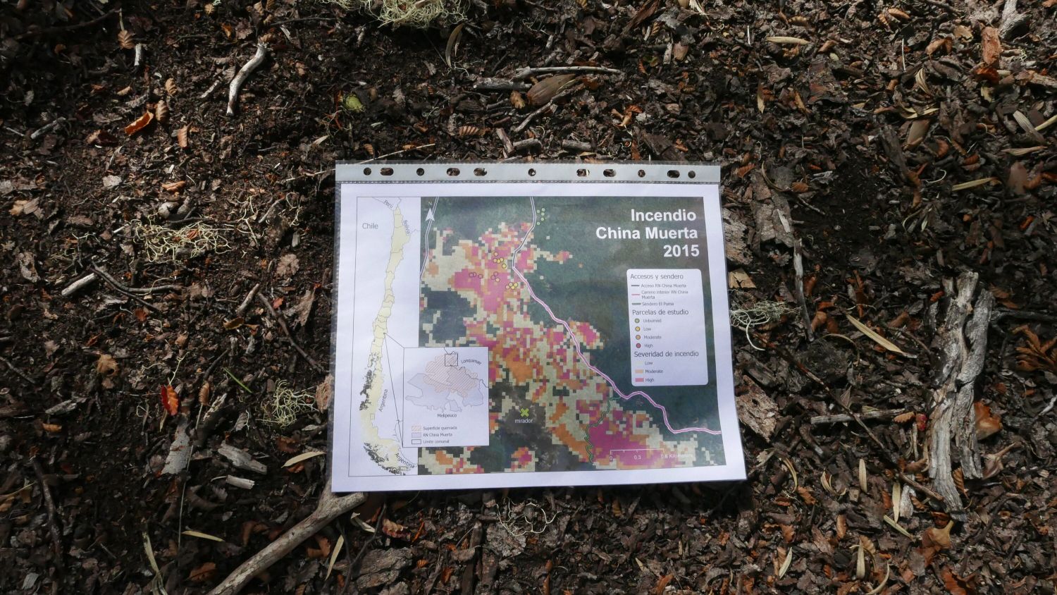
Map from Paola Arroyo Vargas showing extent of China Muerta fire in 2015. Jennifer Gabrys, 2024.
Andrés Fuentes Ramírez is a biologist with a PhD in ecology and evolutionary biology, and Paola Arroyo Vargas is an engineer in renewable natural resources with a PhD in fire ecology. In this conversation with Maya Errázuriz from Fundación Mar Adentro and Jennifer Gabrys from the Smart Forests project, we approach the study of fire from an ecological point of view to better understand the work of monitoring the effects of fires on araucaria and nothofagus forests in China Muerta, as well as the technological gaps that exist between academia and the public sector when it comes to making on-site decisions regarding the regeneration and restoration of sites affected by fires.
Fundación Mar Adentro (FMA): To begin with, could you tell us about the main purpose of the Ecosystems and Forests Laboratory that you lead at the Universidad de la Frontera, as well as your individual research projects?
Paola Arroyo (PA): I am an engineer in renewable natural resources. I became interested in the topic of fire ecology through a research project that Andrés was awarded ten years ago, and I participated in it as a master's student, which led to my first fieldwork in China Muerta. It also paved the way for me to continue with a PhD focused on evaluating the effects of recent fires on Andean ecosystems dominated by these characteristic araucaria and lenga forests. So, what we have been looking at from different perspectives is the effect of fires from an ecological perspective and specifically how these forests have responded after the fire. I have also been awarded a grant that will allow me to continue this research for another three years, but on a landscape scale, and this will also be complemented by the lines of research being carried out here in the laboratory. This will enable us to take a more comprehensive approach to what is happening in these ecosystems that are “suffering” from this change to a more frequent and severe fire regime.
Andrés Fuentes (AF): I, on the other hand, trained as a biologist and then did a master's degree in botany, where I studied invasive plant species and their impact on natural ecosystems. This indirectly led me to issues related to fire regimes and how invasive plants were also part of this equation. Subsequently, between 2010 and 2015, I did a PhD in ecology and evolutionary biology in the United States, and when I returned to Chile, I became a researcher, and today, as an associate professor in the Department of Forest Sciences at La Frontera University, where I have been working for almost ten years and focused almost 100 percent, I would say, on issues related to fire ecology, from understanding the very basic impacts that fire has on vegetation and on soil chemistry and biology. Like Paola, I am part of the Ecosystems and Forests Laboratory, which is a more interdisciplinary laboratory, where we have broadened our view a little beyond trees, beyond the forest, and today we are also complemented by fellow researchers working on the biodiversity of microorganisms, on topics related to fungi, forest ecosystem services, and restoration. From there, our mission is to have an impact on the management and conservation of areas that have experienced some degree of disturbance or disruption, such as fire, and to be useful in carrying out initiatives for the recovery, restoration, or rehabilitation of these ecosystems.
Smart Forests (SF): So, what does fire ecology involve and how does it relate to biodiversity conservation?
AF: It is important to start with the idea that fire is a physical thing, but there is also a biological and chemical interaction. Then, if we understand ecology as a concept that brings together various things, it becomes easier to understand how this concept operates in relation to forest fires. Fire ecology seeks to understand the impacts of fire on forest biodiversity.
PA: These impacts are not only associated with natural events, but also with certain human activities that are associated with certain places. So, from that perspective, we are all actors who can potentially relate to fire and its ecology, and that is precisely the point: to seek a greater understanding of these issues among the various communities in the territories affected by fires.
FMA: Andrés, in relation to what you were telling us about the current changes in fire regimes, what have these changes been, particularly in the Araucanía region? And then we'll move on, Paola, I'm going to ask you a question that is also specific to your area.
AF: The vegetation in Chile is very different depending on the territory where we are, right? There is a climatic gradient as well as other issues that make the vegetation different in each part of the country. And each place has different evolutionary characteristics that allow it to coexist with fire. In many cases, fire can help them, and it is part of their growth dynamics, allowing new shoots to grow again, seeds to germinate more quickly, etc. Native species in South America have not been exposed to frequent fires evolutionarily speaking, so in general, our vegetation is not co-dependent on fire. However, these new exotic or introduced species, which are usually from North America or Europe, are much more responsive to fire. So, one of the first things we ask ourselves is: how have fire regimes changed? How frequent are they? What is their magnitude in terms of the damage they cause due to their severity? And also, what is their seasonality? And when you compare the last two or three decades, we see that they are much more frequent, more severe, and cause greater damage. So the pressure experienced by vegetation that does not have these adaptations to fire is greater. Our studies have therefore focused first on finding out specifically which plant species are most harmed and which ones benefit. And, more or less, what are the recovery trajectories of the forest when it is subjected to a severe forest fire? That is what we have been seeing in recent decades. So, in that context, we have been studying the China Muerta Reserve as a site, as a study model. Today, I almost consider it an experimental station where we already have ten years of data, and we hope to continue studying for many more years. We have a permanent monitoring system in place where we measure various species at different times to understand these dynamics. Once we have a clear idea of which species or plant compositions change in relation to fires, we begin to ask ourselves other more specific questions that have to do with the relationships between species, for example, and between vegetation and soil. So, we are looking at what happens to soil microorganisms when an area is burned, and how the symbiosis between native plants and microorganisms can be restored. We also run a nursery where we grow plants that have been improved by beneficial fungi and bacteria in the soil, which allows those plants, when we plant them in burned areas, to thrive and survive, grow, and make the restoration process more efficient. So, we have moved from very macro questions to more applied issues, and today that has also led us to a very interesting public-private partnership with CONAF, for example, which produce plants and large nurseries that will also contribute to this applied research.
FMA: And, in relation to climate change, how has it affected the Araucanía region?
AF: This region had a very severe fire season in 2015 (in the China Muerta Reserve), and after that, fortunately, it has not been the region with the highest incidence of fires. It has been the regions of Biobío, Maule, and Valparaíso that have suffered the most in recent years. When you start to look at the factors that contribute to these fires becoming increasingly severe, the first thing to note is human activity. It is also important to clarify this. The vast majority of forest fires in Chile are caused by human action, whether through negligence, misuse of fire, or even intentionality. Basically, that is the root of the problem. And, of course, we also have climatic anomalies such as summer periods with heat waves and strong winds, which increase the likelihood of a mega-fire, as they are called. Therefore, I would say that there is an important distinction between the occurrence, the root cause, which is always human in origin, and the factors that can accelerate the fire and make its magnitude and effects more devastating. This is where climatic factors can contribute. When a mega-fire occurs and the climatic factors are “ideal”, there is virtually no capacity to control it. Any capacity that CONAF or another agency may have falls short in such a scenario.
FMA: Returning to the research in the China Muerta Reserve, Paola, what have you observed about the regeneration of the araucaria?
PA: What we have seen after these mega-fires in this area is how the response of these two species (araucaria and lenga) has been different. First of all, because each of these species has different characteristics in its relationship with fire. For example, the araucaria itself has certain adaptations. It has thicker bark. Adult trees begin to eliminate the lower branches. This prevents vertical connectivity when there is a fire, meaning that the fire does not reach the canopy. Lenga and other species of Nothofagus burn easily. We have seen that in areas severely affected by forest fires, lenga practically disappears from the area, whereas we do find araucarias that survive these effects and can regenerate. This has been very noticeable in these places, and we have identified it in different areas, both in China Muerta and in other forests with similar characteristics. So, in the laboratory, we have been working on what can be done to help the regeneration of lenga. Nothofagus trees are more sensitive; they need different conditions and cannot be completely exposed to the sun and radiation, because otherwise they dry out. Araucaria trees, on the other hand, are more tolerant and can be in more exposed conditions. During a recent visit to the site, we observed how some araucaria trees that survived the fire are dead, while others apparently dead have sprouts in their crowns. This opened up another line of research to understand what is happening at the landscape level. This is called delayed mortality, where we study how fire damages or modifies the mortality of a species several years after a fire incident. We also evaluated why some trees of the same species survive and others do not.
SF: This new line of research is very interesting. In relation to this, how does this work relate to the technologies currently used in Chile for monitoring forest fires?
AF: That's a good question. There is still a long way to go, but we also have good access to technologies from a scientific point of view in terms of high-quality satellite imagery, the use of drones with high-performance sensors, towers to measure carbon emissions, and weather stations to monitor variables in near real time. However, I see that there is still a gap between what science can produce with technology and what land management can achieve in practice. For example, this year, through a research project, we are now able to obtain good resources to install a high-quality weather station with very specific sensors that will give us very good data on various climate variables in burned forests. We will also be able to fly multispectral drones with very specific sensors that will allow us to obtain information on a much larger scale regarding how vegetation is recovering through the calculation of indices that are available using these devices. But this is mainly for scientific purposes. It will allow us to publish things that we do not know today, attend conferences, and train students so that they can also be part of this. However, I still think it is a long way off before this helps us influence public policy. At the macro level, I do believe that we can have a good impact at the local level with the custodians who are in the reserves, and that we can quickly deliver this information to them to help them make decisions about where to plant or not to plant, or which areas require more attention.
PA: I completely agree with what Andrés says. We have a tremendous gap between what can be done in academia and what can actually be done in public services. It is worth noting that in recent years, technology has advanced greatly, allowing us to work with certain things that enable us to study these ecosystems, and one of those things Andrés mentioned, for example, is the evolution of satellite imagery. In general, we have worked with satellite images that have a resolution of 30 x 30 meters. Then, in 2015–2016, Sentinel appeared, which has a resolution of 10 x 10 meters, thus improving what we can identify on the ground. The technologies themselves have helped us in our studies. However, the time it takes to process everything we collect and translate it into something more tangible is where the gap lies.
FMA: What remains to be studied about forest fires in Chile?
AF: There will always be questions and things to find out from a scientific point of view, but I think it is important to move on to the practical side. First of all, I think it is important to place a lot of emphasis on prevention. Perhaps a new line of research could focus on the most efficient ways to contribute to prevention. It would be interesting to raise new questions about how to ensure that decisions are not reactive but as preventive as possible. And secondly, we should ask ourselves how to most efficiently restore an ecosystem that has suffered a fire, if what is really required is to restore that ecosystem. And there I think we still have a lot of work to do, because what is traditionally done is that something that burns is left as it is to recover on its own. But that does not always happen as it should, because if we do not have seedbeds, other species will arrive. And then comes the whole issue of land-use change, which is ultimately very difficult to recover. So, I believe it is also important that, with the knowledge we already have, we make progress on issues related to the recovery, restoration, and reforestation of these sites.
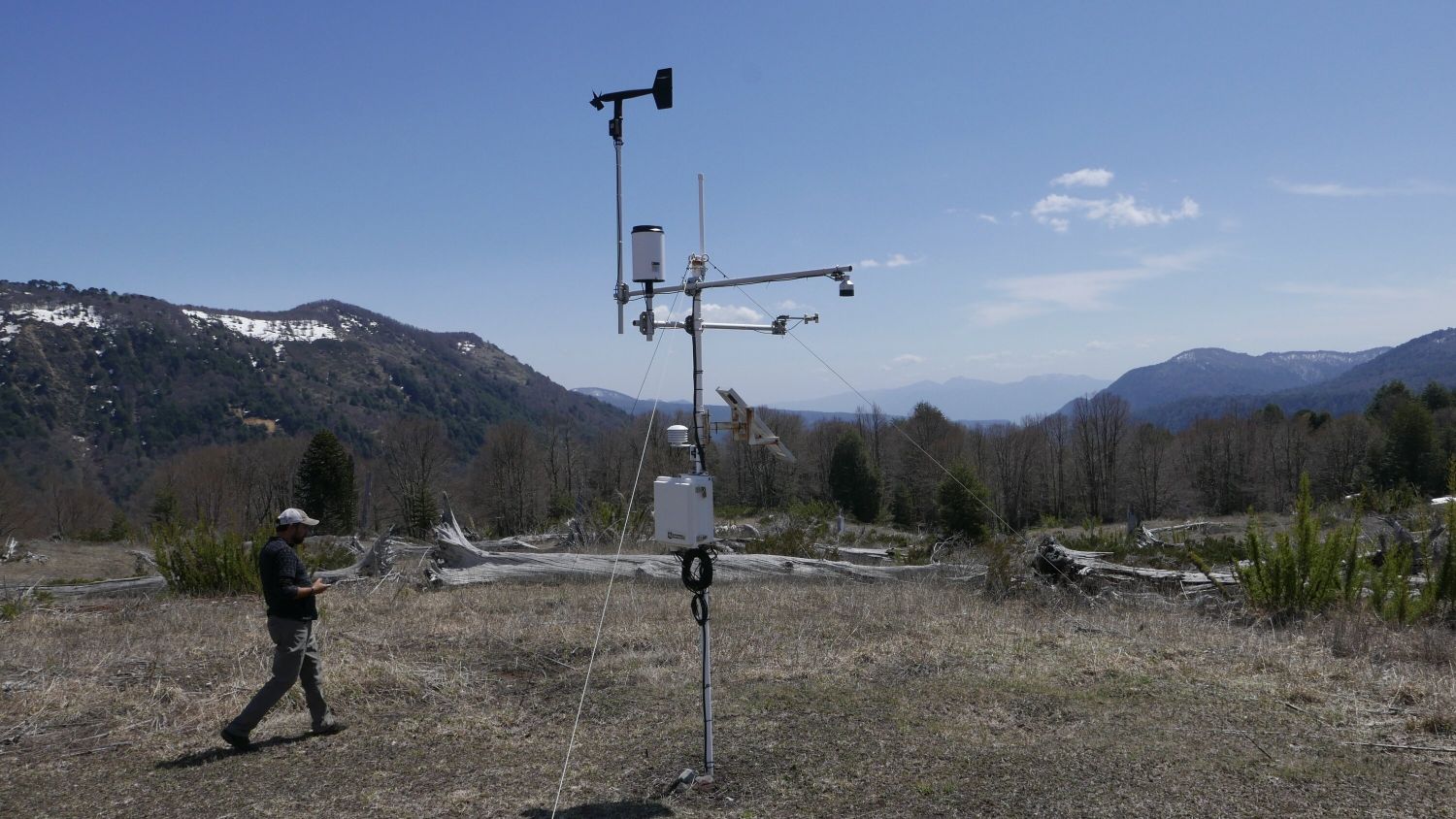
Andrés Fuentes Ramírez at weather monitoring station, Bosque Pehuén. Jennifer Gabrys, 2024.
Flammability Diagrams
Valeria Palma
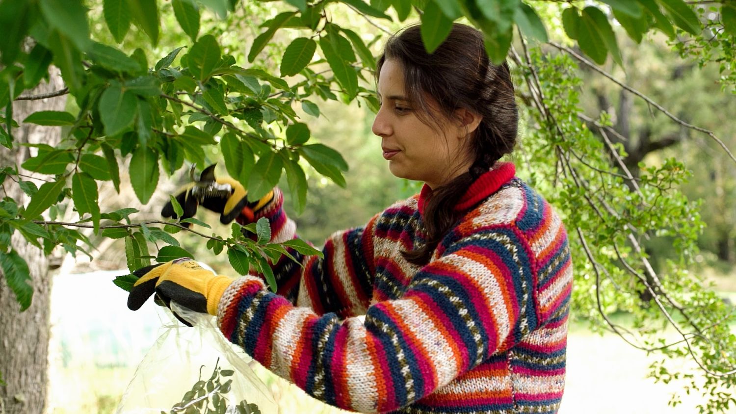
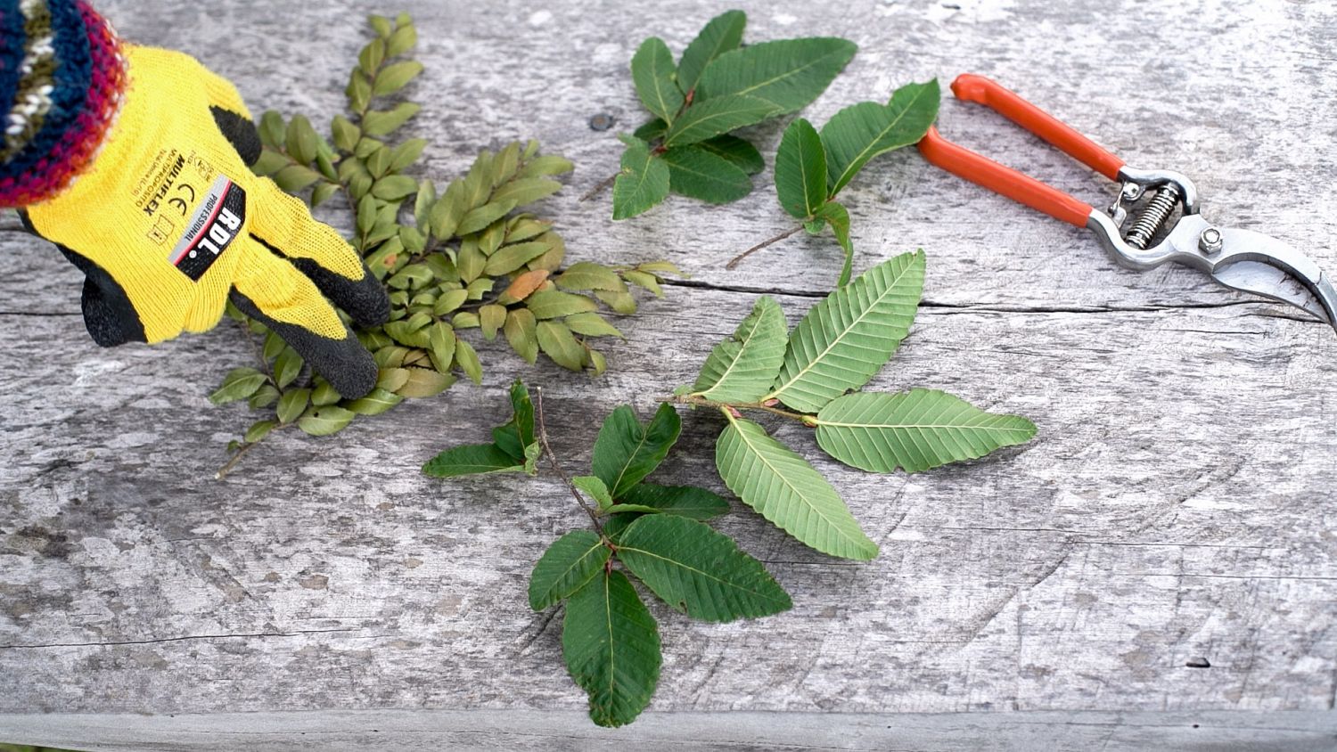
Valeria Palma collecting plant material for her research process in Bosque Pehuén, Araucanía. Andrea Novoa, 2024.
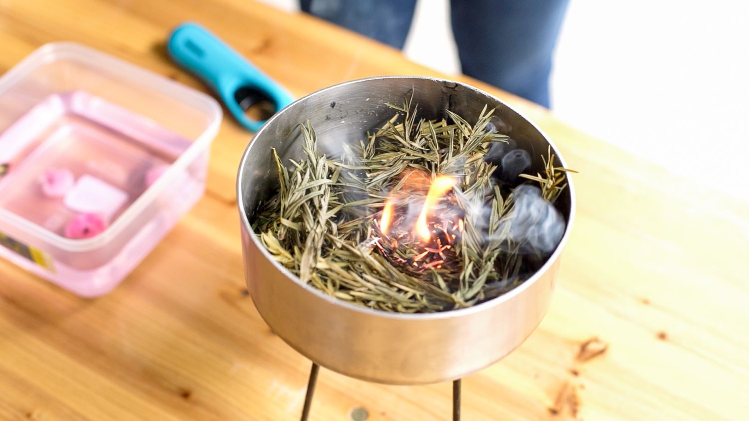
For this study, I characterized the flammability of five species present in the Pehuen Forest: Araucaria araucana (araucaria), Laureliopsis philippiana (tepa), Nothofagus alpina (raulí), Nothofagus dombeyi (coihue), and Saxegothaea conspicua (female mañío). Of these species, tepa stands out for its pungent lemony smell, which could indicate that it is more flammable than the rest. I made this characterization based on H.E. Anderson's (1970) definition of flammability, which defines it as the set of measures of ignitability, sustainability and combustibility. Subsequently, Martin, together with other researchers in 1993, contributed to this definition by incorporating a fourth measure: consumability.
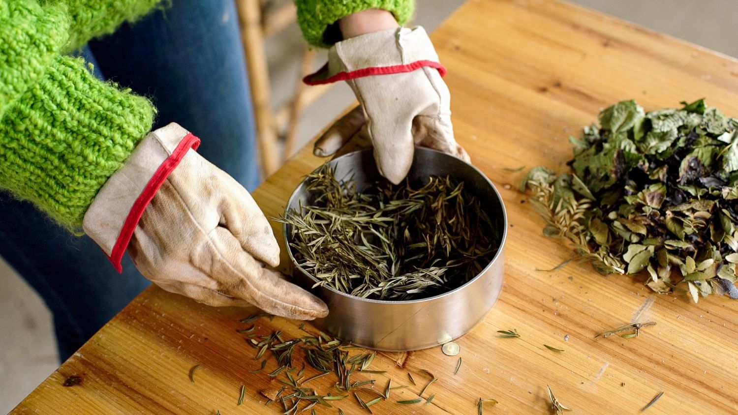
The variables evaluated in each test consist of measuring times (ignition, visible flame and combustion) and masses (difference in mass and gradual loss of mass) in ten tests per species, which are directly related to each of the concepts of flammability.
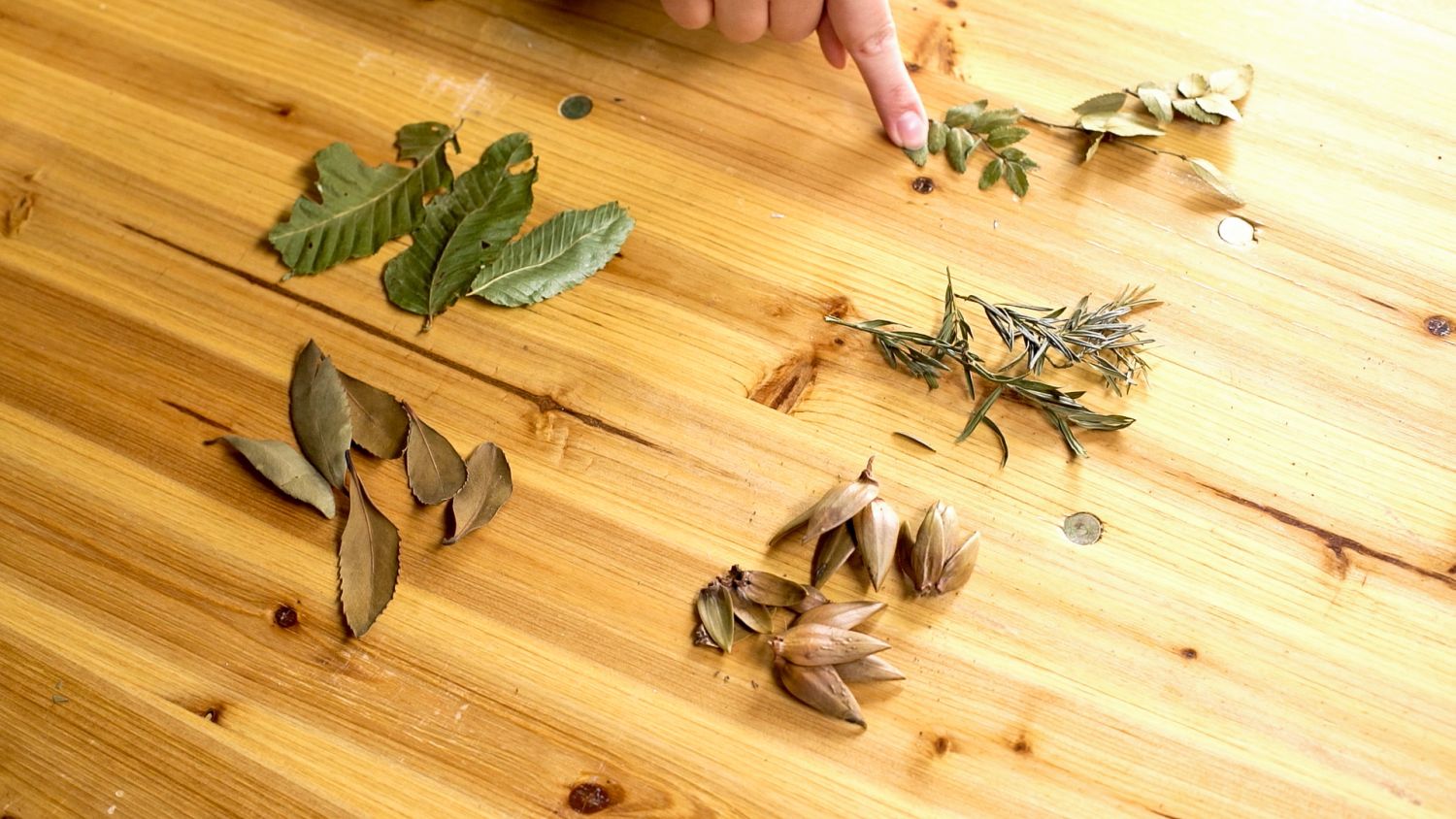
Raulí and coihue leaves collected by Valeria Palma for her research on the flammability of native species during the Bosque Pehuén – Ecologies of Fire residency program. Andrea Novoa, 2024.
Graph 1. IGNITABILITY. Ignition time by species
Ignitability consists of time, in seconds, from when the source of fire is brought close to when the fire starts in the plant material. Each point corresponds to a test. Visually and statistically, Araucaria araucana is the only species that behaves differently from the others, taking longer to ignite with a median of 30 seconds. In terms of ignition, this species can be considered less flammable. The other species ignite much more quickly, with median time between 10 and 15 seconds, making them more flammable.
During the Ecologies of Fire residency program, Valeria Palma characterized the flammability of five species present in Bosque Pehuen: Araucaria araucana (araucaria), Laureliopsis philippiana (tepa), Nothofagus alpina (raulí), Nothofagus dombeyi (coihue), Saxegothaea conspicua (female Mañío). Andrea Novoa, 2024.
Graph 2. SUSTAINABILITY. Visible flame time by species
Sustainability is the time, in minutes, from ignition until the flame is extinguished in the plant material. Visually, Laureliopsis philippiana (tepa) and Nothofagus dombeyi (coihue) exhibit unclear behavior, with a flame that is sometimes lit for less than 15 seconds and sometimes for up to 2 minutes. Despite this, only tepa shows statistical differences from araucaria. It should be noted that araucaria, raulí and female mañío are unable to maintain a flame for a considerable time, which makes them less dangerous in a forest environment, as it is unlikely that they will be able to spread the flame to another individual in that time.
During the Ecologies of Fire residency program, Valeria Palma characterized the flammability of five species present in Bosque Pehuen: Araucaria araucana (araucaria), Laureliopsis philippiana (tepa), Nothofagus alpina (raulí), Nothofagus dombeyi (coihue), Saxegothaea conspicua (female Mañío). Andrea Novoa, 2024.
Graph 3. COMBUSTIBILITY. Total combustion time by species
Combustibility is the time, in minutes, from ignition until the last ember is extinguished. Visually, Laureliopsis philippiana (tepa) takes longer to burn completely than the other species, reaching almost 10 minutes, followed by coihue at approximately 3 minutes of combustion, and then the other species at less than 2 minutes. Statistically, it can only be said that tepa differs from raulí and araucaria. It is important to note that embers generated during the combustion process can reignite the fire, making them dangerous. The longer they burn, the more flammable the fuel is.
Graph 4. CONSUMABILITY. Difference in mass by species.
Here, consumability measures the difference in grams between the initial mass (25g) and the mass after combustion. Visually, it can be seen that tepa and coihue are the species that lose the most mass after combustion. On the other hand, araucaria, raulí, and female mañío lose very little of their structure. The process of mass loss is clearly visible in the “consumability” graph.
During the Ecologies of Fire residency program, Valeria Palma characterized the flammability of five species present in Bosque Pehuen: Araucaria araucana (araucaria), Laureliopsis philippiana (tepa), Nothofagus alpina (raulí), Nothofagus dombeyi (coihue), Saxegothaea conspicua (female Mañío). Andrea Novoa, 2024.
Graph 5. CONSUMABILITY. Average mass loss vs. combustion time.
This measure of consumability records mass loss as a percentage every 10 seconds from ignition until combustion ends. From this, it can be seen that araucaria and raulí practically do not suffer a significant loss of mass, with a loss of around 1 percent. These species are followed by coihue and female mañío with a mass loss of between 5 and 6 percent. Finally, tepa is the species that suffers the most damage during the combustion process, with a loss of 17 percent.
Although tepa is the most flammable of the five species considered in this study, as well as being the most aromatic, it is still a resistant species compared to the species of the central valley, which can lose more than 90 percent of their initial mass. This is because the mountain species co-evolved with fire and became increasingly resistant to survive in mountain ecosystems. This is why araucaria, the most evolutionarily ancient species, is the most resistant. The species of the central valley are not adapted to fire, which is why forest fires are devastating in these areas.